Showing posts with label SMMC. Show all posts

Sunday, November 9, 2014

Red Car Property: Trail In Plans Since 1968


Photo: Diane Edwardson, March 28 2012.  Dodging cars with kids & on-leash dogs, south of the Silver Lake Ave Public Staircase, is trickier in the rainy season.  (Click on photos to enlarge.)
Photo: Diane Edwardson, November 27, 2011. The exact same stretch of trail without cars is more inviting to walk.

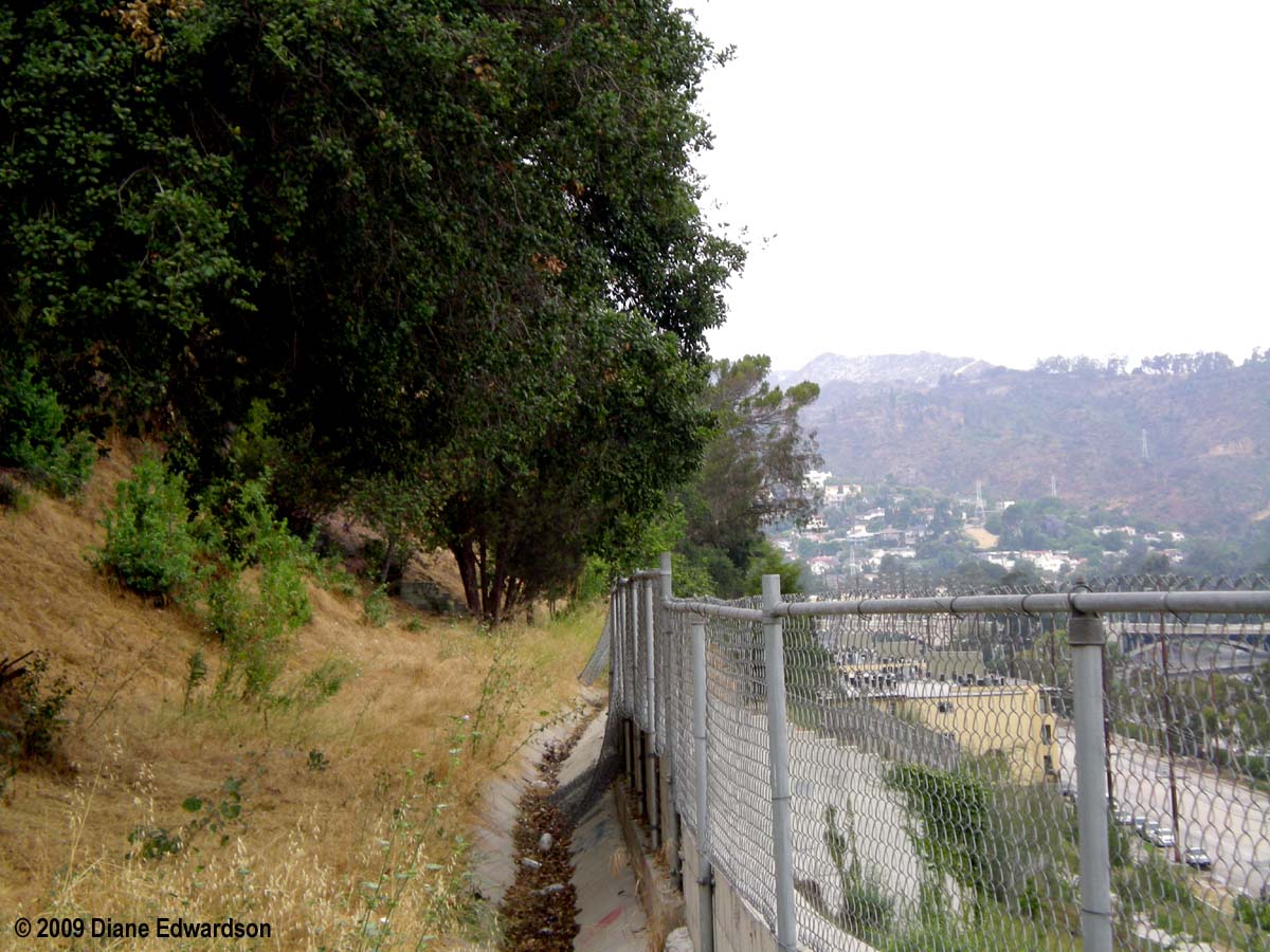
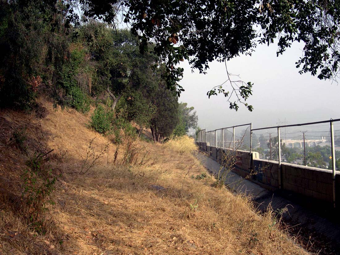
The Red Car Property is not a park, it just looks like one.  A former privately owned right-of-way for the Pacific Electric Red Car Trolley Glendale Line, it is still private property that we've all been trespassing on since the tracks were removed in 1955.  

Due to it's unique length, shape, grade & location, in the middle of a residential neighborhood, it is an ideal trail for non-motorized use, connecting people to parks, schools & recreational facilities in a heavily freeway & topographically divided neighborhood.

Planners took note and, for decades, included the Red Car Property as a part of a larger trail system in various State & City plans, including the Santa Monica Mountains Conservancy's El Pueblo Trail (1983), a part of the Rim of the Valley Trail Corridor  in the Santa Monica Mountains Conservancy Zone (enabled by State Public Resources Code in 1979); Silver Lake - Echo Park - Elysian Valley Community Plan (1984); as a key link from surrounding community to LA River in LA River Revitalization Master Plan (2007).

It even shows up as far back as 1968 in the City of Los Angeles Equestrian Trails Master Plan showing a general alignment through the hillside area west of the 5 Freeway between Griffith & Elysian Parks. The plan encourages hikers' use of equestrian trails to increase trail safety.

Since its inception 6 years ago, The Big Parade LA has included The Corralitas Red Car Property as a key link in the Silver Lake Loop as part of a growing urban trails movement using public staircases and rights-of-way, encouraging walking our neighborhoods instead of driving between Downtown Los Angeles & the Hollywood Sign in an organized 2-day hike.  

The Red Car Property is not a park, it just looks like one. 

Sunday, August 17, 2014

LA River: Marsh Park Phase 2 Now Open

Photo: Diane Edwardson, August 16, 2014.  The latest addition to the Santa Monica Mountains Conservancy's Marsh Park features a spectacular gate to the river & some imposing signage forbidding, among other things, martinis in the river channel (defined as, I believe. 6' from the water line).  (Click on photos to enlarge.)

The 3-acre parcel now open also features exercise equipment in a fitness trail, grassy areas, bioswales, native plantings, bathrooms a river rock seating area near the river & an open Spanish revival style patio area (reminiscent of the River Center at the old Lawry's California Center) for rent for special events. 
Photo: Diane Edwardson, August 16, 2014. In front of a crowd of several hundred community members & children, a host of politicians and other officials talked for far too long before cutting the ribbon & opening the new park gates to the LA River.  Among those cutting the ribbon included FoLAR Founder Lewis MacAdams,  former City Councilmember Ed Reyes (CD1), City Councilmember Mitch O'Farrell (CD13), Mayor Eric Garcetti, State Senate President Pro Tem Kevin DeLeon (SD22), Board of Public Works Barbara Romero, City Councilmember Tom LaBonge (CD4), Executive Director of Santa Monica Mountains Conservancy Joe Edmiston, and LAUSD Boardmember Bennett Kayser.  From all the media & folks taking cell phone photos, you would think movie stars were present. People here just really want parks & trees.

It was a festive occasion with live music, an endless supply of food (for those who waited through the speeches), & educational demos on how biofiltration works around the park. 

Friday, August 15, 2014

LA River: Marsh Park Phase 2 Grand Opening, Saturday, August 16, 2014, 11:30 AM

Photo: Diane Edwardson, April 23, 2011. Phase 1 included fanciful playground equipment in the LA River adjacent park.  (Click on photos to enlarge.)

Santa Monica Mountains Conservancy hosts the Grand Opening of 
Saturday August 16, 2014
11:30 AM
2960 Marsh St, Elysian Valley
The event is family friendly

The 3 new acres of park space will include bathrooms, something sorely needed along the LA River for those who bike, walk or kayak the river.  It will also include space available for rent  for special events, bioswales, native plants & a really lovely gate.  See story & current photos: KCET
Photo: Diane Edwardson, May 27, 2013.  You can put in your kayak at Marsh Park too.

If you're coming from the Red Car Neighborhood, we recommend walking, biking, kayaking or carpooling to this event.  Elysian Valley is an older neighborhood easily overwhelmed by large events when people drive in.  Make a day of it.  Visit Friends of the LA River (FoLAR) sponsored Frog Spot just a few blocks south on the River Path at Benedict Street.

Monday, May 27, 2013

LA River: Kayaking Elysian Valley Photo Op

Photo: Diane Edwardson, May 27, 2013.  State & City officials & the Santa Monica Mountains Conservancy (SMMC) celebrated (at Marsh Park) the opening of the LA River Recreation Zone Pilot Program.  (Click on photos to enlarge.)
Photo: Diane Edwardson, May 27, 2013.  SMMC Director Joseph Edmiston presented outgoing City Councilmember (CD1) Ed Reyes wit an honorary ranger hat for all his efforts to open the river for recreational use.
Photo: Diane Edwardson, May 27, 2013.  As if to illustrate the story City Councilmember-elect Mitch O'Farrell told about being "baptized in the LA River" on his kayaking journey this morning, a loud splash was followed by laughter & squeamish "eeeewwwws" by those watching the kayakers from the bike path.  Yes, you will get wet if you go kayaking in the LA River.
Photo: Diane Edwardson, May 27, 2013.  There are two groups already offering commercial kayak tours of the LA River through Elysian Valley:

LA River Kayak Safari
LA River Expeditions

Read more about kayaking the recreation zone pilot program:
The Eastsider

Monday, February 25, 2013

LA River Recreational Zone (& River Channel Dog Ban) Back On City Council Agenda Today


Photo: Diane Edwardson. Under the proposed rules people will be allowed in the river channel but even on-leash dogs will be banned.  On-leash dogs will only be allowed on the bike path. (Click on photo to enlarge.)

The LA City Council Ad-Hoc River Committee will hold a public hearing on the proposed rules and parameters for the LA River Recreational Zone pilot program this afternoon in City Hall.  

According to Lupe Vela, senior staff for City Councilmember Ed Reyes, the recreational zone itself has been scaled back due to construction on the pedestrian/bike/equestrian bridge at Atwater Creek; retrofitting of the historic bridge on Fletcher Drive; construction of the new Riverside Drive Bridge crossing the river near the Confluence.  However, the recreational zone seems to be moving forward quickly nonetheless. 

PUBLIC HEARING TODAY
LA CIty Council Ad-Hoc River Committee
Monday February 25, 2013
3PM
LA City Hall
200 N. Spring St, Room 1060
Los Angeles, CA 90012
 

Photo: Diane Edwardson, 2010.  Horses are considered livestock so they would not be included in the ban. Currently horses have a place they can cross in the river near Atwater Creek, near the site of this photo.  It often looks as if the horses are walking on the water, as it is just a concrete berm just under the water. 
 

Monday, August 1, 2011

LA River: Arundo Removal In Elysian Valley

Photo: Diane Edwardson, July 29, 2011.  Work crews in Elysian Valley had the tough task of removing Arundo from the LA River and hauling it up the steep banks by hand. (Click on photo to enlarge.) 

Arundo is a non-native, highly invasive and combustible giant grass threatening ecosystems in California waterways and hillsides like the Red Car Property. 


Sunday, June 19, 2011

Elysian Valley: Free Community Campfire & Marshmallow Roast, Wed, June 22, 2011

Photo: Diane Edwardson, April 23, 2011.  Marsh Street Park on the LA River features an artistic playground.  (Click on photo to enlarge.) 

Wednesday, June 22, 2011
6:30 PM
FREE!
& Marshmallow Roast
Los Angeles, CA 90039

Sponsored by

Friday, April 1, 2011

Semi Tropic Spiritualists' Tract: Another Speculator Buys The Turkey

Photo: Diane Edwardson, January 3, 2011. The Semi Tropic Spiritualists' Tract lots destined for 15-home development are roughly outlined and adjacent to the 2 Freeway. (Click on photo to enlarge.)

Another speculator intends to build the 15-home small lot subdivision in the Semi-Tropic Spiritualists' Tract. See The Eastsider for the complete story.

Considering the other home developments on the Orange County-based developer's website seem to be on already flat land, it is highly likely we'll see another failed development on this site.

Hillside construction in this corridor has a long Legacy of Failed Development. Let's hope they give up before they start cutting down trees and
cutting into the hillside leaving a denuded slope to build slab-on-grade flat pads.
Photo: Diane Edwardson, February 27, 2011. In February, new test pits for soils were dug. (Click on photo to enlarge.)

In 2009, neighbors lost the appeal against the 16-lot subdivision. The Santa Monica Mountains Conservancy supported the appeal and objected to the plan as it included no mitigations for the well used urban wildlife corridor through the site.

The approved plan calls for complete destruction of all but 5 trees on the lot and a complete reshaping of the hillside.
Last month, adjacent neighbors received City notice that an application for grading permits was submitted for the project, which includes considerable earth moving:

6,465 cubic yards of cut
195 cubic yards of fill
15,000 cubic yards of remove & recompacted soil
6,270 cubic yards of export

According to the plan, which calls for 1/3 of the property to be "open space," it is unlikely the open space will ever be functional as it will be a compacted slope. Native plants do not grow in compacted slopes.

Click here for all our Semi-Tropic Spiritualists' Tract posts.

Of course there's the stalled development of single family homes in the Red Car Neighborhood that developers who don't know what they're doing in Hillside construction should consider.

Saturday, August 28, 2010

Vista Hermosa Park: Sunday Aug 29, "Animals' Life In The City"


Photo: Diane Edwardson, July 14, 2010. Sometimes, you have to look closely to see coyotes. This one was in Red Car Canyon. (Click on photo to enlarge.)

Our neighborhood wildlife is more varied than you would think. In 2008, Corralitas Drive neighbors discovered gray fox living among us. Our wildlife posts tend to be the most popular on the Red Car Blog.

Tomorrow, we recommend taking a short journey to Vista Hermosa Natural Park, on the edge of Downtown (especially if you have kids) for a free event sponsored by the Santa Monica Mountains Conservancy:

Sunday, August 29, 2010
4 PM
Grotto Amphitheater
100 N. Toluca St.
Los Angeles, CA 90026

Thursday, June 10, 2010

Menlo Property: Business As Usual


Photo: Diane Edwardson, June 10, 2010. Now that the Menlo Property has been approved for 120 units, we'll see how quickly it becomes a dumping ground again. (Click on photo to enlarge.)

Money talks. Lots of big name consultants helped convicted slumlord, Sam Menlo & Century Quality Management defeat the Santa Monica Mountains Conservancy's (SMMC) appeal of City Planning's approval of 120 condo units on the Menlo Property.

Last night, many community members spoke in support of the SMMC appeal for a trail easement on the Menlo Property per the Community Plan. Three of the five East Los Angeles Planning Commission members (Lopez, Nagao, Angulo) voted to deny the SMMC's appeal. The other two commissioners took off before our hearing began.

The decision came after City Planning Director Gail Goldberg extolled the virtues and the sanctity of Community Plans to the commission. She too left before our agenda item came up.

Photo: Diane Edwardson, June 10, 2010. Interesting, how this graffiti showed up just upslope of the dumping this morning. It was not there yesterday. (Click on photo to enlarge.)

Keep in mind, Menlo was once approved to build 93 units and failed to build on the property. Menlo allowed the property to become the biggest nuisance property in Silver Lake. So, many remain skeptical we'll see anything built there, anytime soon.

If they do break ground, we can look forward to 212+ days of grading, as they dig out the entire hillside to build even more retaining walls for the 120 condos. That is, if they don't abandon the project, as has happened on this site in the 1980s.

The Red Car Property has a trail the community has used for decades. CD13 has expressed continued support for a trail on the Red Car Property, between the 2 Freeway and Fletcher, as a vital link to the LA River.

Wednesday, June 9, 2010

Menlo Property: Appeal Hearing Today

Photo: Diane Edwardson, March 3, 2009. Public staircases and sidewalks connect the Waverly & Locksley neighborhoods with the LA River, Menlo Property and the Red Car Property. (Click on photo to enlarge.)

The East Los Angeles Planing Commission will hear the appeal filed by the Santa Monica Mountains Conservancy of the approval of the Site Plan Review of the 120 condo units approved for the Menlo Property and Zone Variance for the existing Sam Menlo-owned, 157 unit River Glen Apartments. While City Council's PLUM Committee denied the appeal on the Vesting Tentative Tract, there is still the opportunity for the Planning Commission to make changes to the site plan to accommodate a trail easement per the Community Plan.

East Los Angeles Planning Commission Hearing
Today, June 9, 2010
4:30 PM
Ramona Hall Community Center
4580 Figueroa Street
Los Angeles, CA 90065

Click here for agenda
Case # ZA-2009-0534-ZV-SPR-1A
2600-2850 Riverside Drive, aka The Menlo Property

Photo: Diane Edwardson, June 6, 2009. Drainage to the street and tree-planted medians haven't exactly been addressed in the site plan review. (Click on photo to enlarge).

Read more about the Legacy of Failed Development in our neighborhood.

Friday, June 4, 2010

Menlo Property: Another Appeal Hearing June 9, 2010

Photo: Diane Edwardson, June 14, 2009. The Menlo Property extends upslope from the upper retaining wall. (Click on photo to enlarge.)

The Santa Monica Mountains Conservancy is appealing the Site Plan Review for the 120 condos and Zone Variance for the existing River Glen Apartments. Changes can still be made to the site plan with regard to inclusion of a trail per the Community Plan.

Wednesday, June 9, 2010
4:30 PM

East Los Angeles Planning Commission
Ramona Hall Community Center
4580 Figueroa Street
Los Angeles, CA 90065

Click here for agenda

Case # ZA-2009-0534-ZV-SPR-1A
for 2600-2850 Riverside Drive
aka: The Menlo Property

Tuesday, May 25, 2010

Red Car Property: Tales of Trail Demise Are Greatly Exaggerated


Photo: Diane Edwardson, October 2004. Red Car Property (south of Fletcher) includes City Historic Landmark #770, Pacific Electric Red Car Viaduct Footings. (Click on photo to enlarge.)

NOTE: ALL PHOTOS IN THIS POST ARE OF THE RED CAR PROPERTY, SOUTH OF FLETCHER, NOT OF THE MENLO PROPERTY. Click here for map.

I received a forwarded email with, "We've lost the Red Car Trail" in the subject line. So I felt it necessary to clarify the two parts of the "Red Car Trail" to readers who may not be aware of the different portions of the Red Car Trail corridor through our Silver Lake neighborhood.

The email was from Friends of Griffith Park, who supported the Santa Monica Mountains Conservancy's (SMMC) appeal of the 120-unit condo development on the Menlo Property (north of Fletcher), for failure to include a trail per the Community Plan. We spent much of the last few weeks talking about the Menlo Property on this blog.

Friends of Griffith Park referred to the Menlo Property as the "Red Car Trail." Long-time community activists remember when the trail corridor was chosen by community leaders because the old Red Car right-of-way made a good trail through the community.

JUST TO BE CLEAR: We have NOT lost the trail on the Red Car Property, south of Fletcher to the 2 Freeway at Corralitas Drive - yet. We have lost the trail north of Fletcher, on the Menlo Property.
Photo: Diane Edwardson, July 19, 2009. The Big Parade toured part of the Red Car Property between Adelbert and the historic viaduct footings. (Click on photo to enlarge.)

Both the Menlo Property and the (Corralitas) Red Car Property are part of the El Pueblo Trail. Both properties were in the Pacific Electric Red Car Trolley right-of-way for the Glendale Line. Both properties were connected by the Fletcher Viaduct.

Last week, the City Council denied the SMMC's appeal for the Menlo Property. (There is still another appeal pending for related approvals on the Menlo Property, at the East Area Planning Commission on June 9, 2010.)

Photo: Diane Edwardson, March 20, 2010. Red Car Canyon shows what 50 years of growth can add to a park-like setting. (Click on photo to enlarge.)

The Red Car Property (south of Fletcher) is also private property. Since 1955, the community has used it as a trail. CD13 continues to support our efforts in creating a public trail on the Red Car Property between Corralitas Drive and Fletcher, as it links a large part of the neighborhood to the LA River and eventually the 18-Acre Elysian Park Parcel. There is also potential to connect via a bike trail to the planned park at the 2 Freeway Terminus. Plus, the trail on the Red Car Property stands alone as a well-used recreational resource.

Between 1955 and 1987, the Menlo Property was used similarly as a trail. However, the history of neglect of the Menlo Property prevented all but wildlife from making full use of the trail corridor since 1987. (The Menlo Property is currently in CD4.)
Photo: Diane Edwardson, June 24, 2009. The Red Car Property meadow at Corralitas Drive and the 2 Freeway. (Click on photo to enlarge.)

The Red Car Property and the Corralitas Red Car Property are the same piece of land. For decades, developers only wanted to develop the southern end of the Red Car Property at Corralitas Drive. It was often referred to as the "Corralitas Property." Once we learned of the history of the neighborhood, we rebranded it as the Corralitas Red Car Property.

Corralitas Drive is still the easiest access to the property for people driving to it. If you're on foot, the neighborhood connects via sidewalks and public staircases at numerous places along the mile-long property.

See also: The Legacy of Failed Development

Wednesday, May 19, 2010

Menlo Property: City Council Voted Today*

Photo: August 13, 2009. There's room for a trail behind the Sam Menlo owned Riverglen Apartments. (Click on photo to enlarge.)

The Santa Monica Mountains Conservancy's appeal of the 120 unit condo development for the Menlo Property goes to a vote in City Council today. The City failed to require a General Plan Amendment to remove the trail from the property despite the trail being in the Community Plan since its inception in 1984.

If the City fails to require a Plan Amendment, it will set precedent for planned trails to be easily removed from future developments without going through the required public process.

See also:
Today's LA Times
Menlo Property: Political No Man's Land

*UPDATE: The appeal was denied on the consent agenda.

Tuesday, May 18, 2010

Menlo Property: Political Theater


Photo: August 13, 2009. Menlo Property looking toward Griffith Park and LA River. (Click on photo to enlarge.)

At last week's PLUM hearing for the Santa Monica Mountains Conservancy's (SMMC) appeal of the City's decision to approve 120 units on the Menlo Property without requiring a trail, City Councilmember Tom LaBonge made quite an entrance at the end of the hearing. Waving a map of his district, he testified that the equestrian trail should be moved to the east bank of the LA River. He admitted having no idea how to get the horses back across the river to Elysian Park. The SMMC nor the public was allowed to comment further in the hearing on LaBonge's proposal.

The El Pueblo Trail is called an "equestrian trail" in the Community Plan. The 1968 Equestrian Trails Master Plan for the City encourages hikers to use equestrian trails, as it makes them safer. It shows a general alignment in the area, though not as specific as the Community Plan, first adopted in 1984.

Photo: Diane Edwardson, June 23, 2007. Horses on the El Pueblo Trail, Red Car Property at Corralitas Drive. (Click on photo to enlarge.)

Removing the trail, an element of the Community Plan, from the proposed Menlo Property development, would set precedent in our neighborhood, affecting any future trail easement on the Corralitas Red Car Property (south of Fletcher). It would also allow planned trails throughout the City to be ignored when ever a developer decides they don't want the trail on their property. It is an affront to Community Planning.


Photo: John Waiblinger, July 24, 2009. Horses on the LA River north of Los Feliz.

Moving the trail to the other side of the LA River may have merit, however, it needs to be properly vetted in a public process, via a General Plan Amendment with regard to the Menlo Property development proposal. Not only that, if this is a real proposal to move the trail to the other side of the river, it needs to through a public process with all of the involved neighborhoods and associated Community Plans on both sides of the river.

You can't just pick up the trail and move it arbitrarily.

The SMMC appeal is on the City Council Agenda Wednesday, May 19, 2010.

Thursday, May 13, 2010

Menlo Property: Consultant Thinks Wildlife Can't Get Around 2 Freeway


Photo: Diane Edwardson, January 22, 2010. The Semi Tropic Spiritualists' Tract rises above the 2 Freeway in the background. (Click on photo to enlarge.)

At Tuesday's PLUM hearing of Santa Monica Mountains Conservancy's appeal of the City's approval of 120 condo units on the Menlo Property, the consultant who conducted a biological review (paid for by Menlo), stated wildlife can't move between Griffith and Elysian Parks because of the 2 Freeway.

Perhaps he missed the past week's posts on snakes and coyotes.

If wildlife were trapped by the 2 Freeway, then about 100 residents of Corralitas Drive would be trapped too.

Rosebud Ave goes under the 2 Freeway. It is the only way to reach Corralitas Drive by car. Wildlife routinely use Rosebud, under the 2 Freeway, moving between the Corralitas Red Car Property and Semi Tropic Spiritualists' Tract.

True, neighborhood maps are confusing. The El Pueblo Trail, as marked by horseshoes in the Community Plan map, uses Rosebud to link the Corralitas Red Car Property to the Semi Tropic Spiritualists' Tract and further to Elysian Park.

The Legacy of Failed Development is another argument for promoting wildlife and trail use of these parcels.

Wednesday, May 12, 2010

Menlo Property: Round 3 Goes to Menlo. Next Stop: City Council, May 19, 2010


Silver Lake -Echo Park Community Plan map page from 12-90, shows a planned equestrian trail (U-shaped trail markings start at Glendale Blvd & Riverside Drive moving south under the 2 Frwy toward Elysian Park). (Click on map to enlarge.)

Yesterday, City Council's Planning & Land Use Management (PLUM) Committee denied the appeal by the Santa Monica Mountains Conservancy (SMMC). The SMMC appealed the City's decision to approve 120-unit market-rate condo development for failure to include a trail dedication per the Silver Lake - Echo Park - Elysian Valley Community Plan.

The City is setting a bad precedent by not requiring a General Plan Amendment. Any planned trail can now be deemed "random," and thus ignored by developers without a formal Plan Amendment process.

It reeked of the "Chewbacca Defense." The legal consultant for convicted slumlord Sam Menlo & Century Quality Management, in both his written rebuttal and testimony at the PLUM hearing, kept repeating that the trail markings on the Community Plan map were "random." He never offered any evidence to prove the trail markings were "random." (If you say it enough times, it must be so.)

I presented evidence proving the trail markings in the SL-EP-EV Community Plan were indeed intentionally placed and had not moved since the plan was first adopted in 1984 by City Council. Community members who participated in the 1983 El Pueblo Trail alignment study and the original Community Plan provided written and verbal testimony to PLUM.

Despite credible substantial evidence, not one of the PLUM Committee members even questioned the "randomness" of said trail.

You can be sure, if the tables were turned and a community member insisted a Plan element was "random," the community member would have to present an unbelievable amount of evidence and they would still find for the developer.

The trail on the old version of the Community Plan (above) matches the current version exactly. It's also described as following the old Red Car rights-of-way in the Plan text as well as in a 1983 memo from the SMMC. No one denies the Menlo Property is an old Red Car right-of-way. Yet, the trail markings are "random."

The case goes to the full City Council for a vote on May 19, 2010.

Tuesday, May 11, 2010

Menlo Property: Red Car Property Connection


Photo: Diane Edwardson, 2004. Shot from the public walkway between Waverly Public Staircase and public staircase to HOME Restaurant. (Click on photo to enlarge.)

The Griffith Park to El Pueblo Trail runs along the hills above Riverside Drive, following the old Pacific Electric right of way between Glendale Blvd and the 2 Freeway. The trail between Fletcher and the 2 Freeway (which we refer to interchangeably as the Corralitas Red Car Property or the Red Car Property) is well-used and connected to the neighborhood by a number of streets and public staircases.

Sam Menlo, convicted slumlord, and his Century Quality Management were approved by City Planning to build 120 unit condo development on Riverside Drive, north of Fletcher, along with a zone variance for their existing apartment building on Riverside Drive.

Today, the Santa Monica Mountains Conservancy is appealing the decision for failure to require the trail in the Menlo Property development per the Silver Lake - Echo Park - Elysian Valley Community Plan. The City Council's Planning & Land Use Management Committee will hear the SMMC appeal today.

PLUM Committee Hearing
TODAY, May 11, 2010
3PM
City Hall, Room 350
200 N. Spring St.
Los Angeles, CA 90012

City Council File # 10-0716

Monday, May 10, 2010

Menlo Property: Appeal Hearing Tomorrow


SMMC map of feasible Griffith Park to El Pueblo Trail alignment; segment between Hyperion and the Corralitas Red Car Property at Fletcher. (Click on photo to enlarge.)

The City failed to require dedication of a trail on the Menlo Property when it approved the 120 unit condo development. The Griffith Park to El Pueblo Trail has been in the Silver Lake - Echo Park - Elysian Valley Community Plan since 1984. The trail is the key link in the Santa Monica Mountains Conservancy's (SMMC) Rim of the Valley Trail.

If the City denies the SMMC's appeal, it will set precedent for eliminating trails from Community Plans throughout the City without a formal Plan Amendment process.

It also calls into question the City's value of Community Plans. Why bother with the Community Plan if developers and the City just ignore it? (But then, the City Planning Website isn't exactly set up to be community friendly.)

City Council's Planning & Land Use Management (PLUM) Committee will hear the SMMC's appeal tomorrow.

PLUM Committee Hearing
Tuesday, May 11, 2010
3PM
City Hall, Room 350
200N. Spring St.
Los Angeles, CA 90012

Council File # 10-0716

Sunday, May 9, 2010

Menlo Property: Griffith Park To El Pueblo Trail Is A Wildlife Corridor


Photo: Diane Edwardson, November 25, 2009. There's room for the Griffith Park to El Pueblo Trail behind the Sam Menlo-owned River Glen Apartments. (Click on photo to enlarge.)

The City failed to require convicted slumlord, Sam Menlo & Century Quality Management to dedicate a trail per the Silver Lake - Echo Park Elysian Valley Community Plan. In 1983, the Santa Monica Mountains Conservancy (SMMC) filed the El Pueblo to Griffith Park Trail corridor alignment with the Secretary of State. At the time, community leaders worked with the SMMC and hiked the trail alignment a number of times. The same alignment was designated as an equestrian trail on City land use maps when the first Community Plan was approved in 1984.

Because the corridor links Griffith Park to Elysian Park through a trail in the hills, with minimal street crossings, it also serves as a wildlife corridor. Judging by routine bobcat sightings by neighbors of Elysian Park, as well as gray fox sightings on Corralitas Drive, this is an important corridor for maintaining biodiversity.

The SMMC is appealing the the City's approval of 120 unit condo development on the Menlo Property. The City Council's Planning & Land Use Management Committee will hear the appeal Tuesday.

PLUM Committee Hearing
Tuesday May 11, 2010
3PM
City Hall, Room 350
200N. Spring Street
Los Angeles, CA 90012

City Council File # 10-0716