Showing posts with label Griffith Park. Show all posts

Friday, January 6, 2017

Red Car Property: Mudwatch Lot C

Photo: Red Car Property Neighbor, January 5, 2017.  The fence blocking the walkable portion of the Red Car Property for the Riverside Drive construction site, also crosses the vernal pool on Lot C, forcing pedestrians up the slippery slope to access the portion of the trail the developer left open to the public.  (Click on photos to enlarge.)

The pile of drywall debris dumped a year ago remains to the right side of the frame. But look, through butchered trees, you can see Griffith Park.
Photo: Red Car Property Neighbor, January 5, 2017.  The flat portion, where cars are parked, is the Red Car Property.  It is not a public road, nor is it even a public right of way.  To make it a private street, it would require a discretionary action by City Planning.  The upslope side is also Red Car Property.  It is well documented as the most crumbly slope on the property.  The side where most of the cars are parked, is where neighbors have encroached onto the Red Car Property by 20' or more.

See also: Vernal Pool on Lot C on October 14, 2009

Friday, November 20, 2015

Historic Viaduct Footings: Pensive Patina Man

Photo: Jonathan Vandiveer: November 15, 2015.  Sadly, last weekend was likely Patina Man's last, as he watched over the historic landmark viaduct footings.  (Click on photo to enlarge.)

Sunday, September 6, 2015

Griffith Park: Yesterday's Fire, Sheriff's Helicopter Flying Low Over Silver Ridge

Photo: Diane Edwardson, September 6, 2015, 3:36PM.  The yellow and green LA County Sheriff's Dept helicopter must have been filling up at the Silver Lake Reservoir before flying awfully low over Silver Ridge and Waverly en route to the Griffith Park fire near the golf course yesterday.  (Click on photo to enlarge.)

I don't know for a fact they were filling up at the reservoir, but from the top of Corralitas Drive, it sure sounded that way.  I think they fly low to alert us that something is going on, since the weekend news is awfully short staffed.  Once again, the Eastsider was on top of the story.  And, because as the ever present billboard at Riverside and Fletcher reminds us, "Wildfire embers can travel over a mile."

You can alway check @lafd for urgent fire and emergency news on Twitter.

Wednesday, May 6, 2015

Red Car Property: Not A Park, It Just Looks Like One

Photo: Diane Edwardson, April 25, 2015.  Without the power lines, the Red Car Property would be downright rural.  That's Griffith Park in the distance.   (Click on photo to enlarge.)

Wednesday, April 29, 2015

Riverside & Fletcher: "Wildfire Embers Can Travel Over One Mile"

Photo: Diane Edwardson, April 19, 2015.  The billboard on the corner of Riverside & Fletcher has a timely message.  (Click on photo to enlarge.)

A brush fire broke out in Elysian Park this morning.  LAFD said the cause was a homeless camp's  cooking fire.  More: The Eastsider 

Get your brush clearance done!  LAFD brush inspections begin May 1.

UPDATE 4-30-15: The graffiti on the Waverly Public Staircase was painted over.

Wednesday, April 15, 2015

Red Car Property: On A Clear Day You Can See Griffith Observatory

Photo: Diane Edwardson, April 12, 2015.  Leaves have returned to the protected native California Black Walnut Trees and the weeds are dry.  (Click on photos to enlarge.)
Photo: Diane Edwardson, February 28, 2015.  What a difference 6 weeks makes.   

LAFD brush clearance inspections start May 1.

Wednesday, March 11, 2015

Red Car Property: On A Clear Day You Can See Griffith Observatory

Photo: Diane Edwardson, February 28, 2015. From the Red Car Property near the Adelbert cut-through.

Tuesday, September 2, 2014

Red Car Property: Butterflies Need Connectivity Too

Photo: Diane Edwardson, May 31, 2014.  Male Checkered White Butterfly* (Pontia protodice) near the historic viaduct footings.  (Click on photos to enlarge.) 

Red Car Property neighbors have noticed an increase in butterflies this summer.  So much so, it seems at times butterflies have replaced hawks as the predominant winged creature on the blog. 

Biologists Dan Cooper & Tim Bonebrake have been studying butterflies in Griffith Park.  Their study was just published in the Journal of Insect Conservation.  Their work looks at 100 years of records in addition to current numbers and extinction rates in Griffith Park (h/o LA Observed).
Photo: Diane Edwardson, July 25, 2014.  Female Checkered White Butterfly* on the Corralitas end of the Red Car Property.  

Bonebrake & Cooper call for urban conservation strategies connecting habitat fragments with larger islands like Griffith Park for increased genetic diversity.  (Cooper has worked as a biological resource consultant to the Mountains Recreation & Conservation Authority, on both the Semi Tropic Spiritualists' Tract subdivision & Menlo Property appeals.)

So the way I read this, it sounds like another good reason to conserve native hillside habitat between Griffith Park & Elysian Park. It's not just butterflies that need genetic diversity, but all species. 
Photo: Diane Edwardson, July 25, 2014.  Female Checkered White Butterfly* on the Corralitas end of the Red Car Property.

Read more: LA Observed 

Journal of Insect Conservation, T. Bonebrake & D. Cooper, 2014

All our Red Car Property Neighborhood butterfly posts


*No expert was consulted for the original ID on these butterflies.  However we are fairly confident in our earlier ID.

Saturday, September 14, 2013

LA River: A Whole Lot of Stuff Going On

Photo: Diane Edwardson, August 23, 2013.  North Broadway Street Bridge crossing the LA River with Elysian Park in the background.  (Click on photos to enlarge.)

The Army Corps of Engineers released its feasibility study for ecological restoration of a good portion of the LA River between Griffith Park & Lincoln Heights (thus signaling real estate speculators where the next hot markets will be).
Photo: Diane Edwardson, August 23, 2013.  Photo op.

Expect even more PR in the coming month about the river, as City, County, State agencies & all manner of organizations wanting a piece of the river pie, trying to get the public to say, "Yes, we want this to happen," so the Federal government will kick in a big chunk of money.  So far, I've seen about dozen announcements and press releases that say very little, other than, read a 500+ page report & comment by November 5, 2013 & go to some community meetings in October. 

I'm not for or against this, I just want simple information.  After 10 years of studying the river you'd think they could give us a 90 day window & some simple 1-page fact sheets. 

Word from Friends of the LA River (FoLAR): In the Study, the Army Corps discusses plans 10, 13, 16 & 20.  The Corps has tentatively chosen Alternative 13.  River advocates are pushing for Alternative 20.

Alternative 13, estimated cost, $453 million: The Eastsider

You can sort through it yourself:

City of Los Angeles, LA River Revitalization
Army Corps of Engineers DRAFT LA River Ecological Restoration Study

Saturday, December 29, 2012

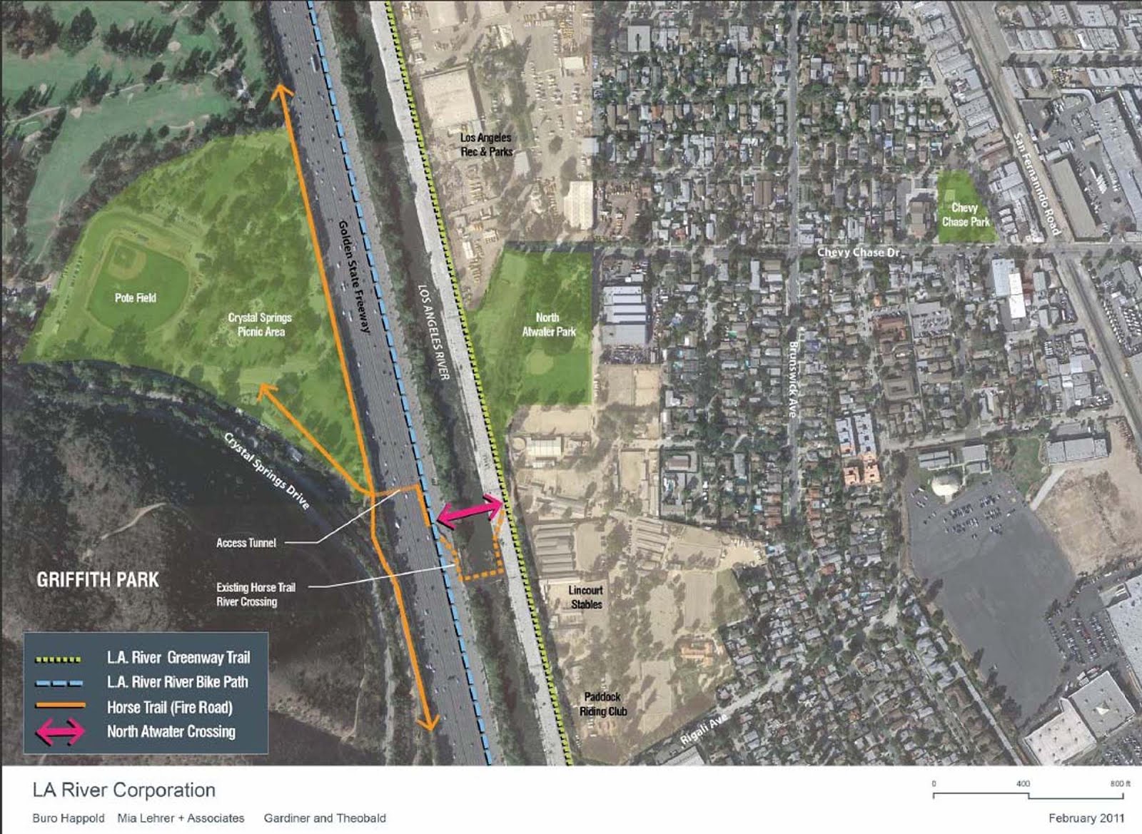
LA River: "North Atwater Crossing (also known as the North Atwater Multi-Modal Bridge over the Los Angeles River)" *Corrected
Stuff We Totally Missed This Year


All images from the City of LA Bureau of Engineering Initial Study posted online for public review for the Mitigated Negative Declaration (MND) on the North Atwater Crossing of the LA River.  (Click on images to enlarge.) 
 
The tall off-center mast is 220.5' high will be 123.5' above the current grade of the bike path.  Does it really need to be that tall just to carry horses, bicyclists and pedestrians?  The Sunnynook Bridge is less obtrusive and surprisingly sturdy.
This bridge won't be Downtown, it's going next to Griffith Park, north of Los Feliz, near the horse stables in Atwater. I don't even think there are any 2 story homes in that neighborhood. It seems to me, the spire with suspension cables might cause trouble for the raptors and migratory birds on the LA River. 
Admittedly, I knew about this MND. It came out for public review right after Thanksgiving and the close of public comments was yesterday. No I haven't read it; you have to pick your battles.  But I'm sorry I didn't look at it sooner, as I had no idea it called for a 220.5'  120.5' tall tower with suspension cables - and will be lit up at night.  People will bitch once it's built.  (People bitch at a 45' tall building - they have no idea how tall 220' 120' really is!) 
 
Will the City be selling it to the highest bidder for a cell phone tower too?  Wonder if that's in the MND.
 
The really interesting aspect of this project is that is being funded privately.  In fact, a year ago this year they attempted to quietly sneak it through the public process. 
 
Related Reading:
 
*Correction 12-30-12: Thanks to our loyal reader and outstanding contributor Jonathan Vandiveer for pointing out the mistake I made in a quick read of the plans.  The plans had the height of the tower listed as "220.5' elevation" not the actual height of the tower.  Thus the risks of writing when you're not fully researched on a topic.  I apologize for any confusion this may have caused.  However, a 120.5' tower is still huge and deserves more scrutiny.  Lighting up something that large in an area with nesting birds and other wildlife will have effects on them.   
 

Friday, December 14, 2012

Corralitas Drive: Sunset Over Silver Ridge

Photo: Diane Edwardson, December 13, 2012.  The clouds were spectacular all day yesterday.  (Click on photo to enlarge.)
 
We're keeping track of rainfall in the Corralitas rain gauge:
 
December 12-13, 2012: 0.15" 
Season to Date: 2.30" 

Friday, November 23, 2012

Red Car Property: Answer To Yesterday's Trivia Question

Photo: Diane Edwardson, August 2003.  It's the curve north of India Street.  (Click on photo to enlarge.)
 
If you look closely at both photos, the hills hidden behind the trees in the far background are Griffith Park.  

Friday, November 18, 2011

Roselin Place: Trees Take The Edge Off Oceans Of Concrete

Photo: Diane Edwardson, November 13, 2011.  Last Sunday was a spectacular day for photos from atop Roselin Place.  (Click on photo to enlarge.)

Since this is one of those hidden views most people in the Red Car Property Neighborhood never see, I'll point out the landmarks.  In the lower right corner is the sign for Rick's Hamburgers and the bright blue Chevron Station at the corner of Riverside & Fletcher.  The dense trees in the lower left corner are on Adelbert and the Red Car Property.  Between the trees and the Chevron Station is Riverside Drive.

The 5 Freeway is adjacent to the concrete walls of LA River.  The arched bridge crossing the river is the Hyperion Bridge.  Atwater is across the river and the big open hillside is Griffith Park.  

Wednesday, September 21, 2011

LA Equine Advisory Committee: Sept 26, 2011 Meeting, Trail Acquisition For Horses & Hikers

Photo: Diane Edwardson, June 23, 2007.  The Red Car Property is within the planned El Pueblo to Griffith Park Trail.  (Click on photo to enlarge.) 

Los Angeles Equine Advisory Committee will host a special presentation by The Trust for Public Lands at their next meeting:

"Acquisition of Park Lands for Local Hikers and Equestrians"

Monday September 26, 2011
6:30 PM

Friendship Auditorium
Los Angeles, CA 90027 

Photo: Jonathan Vandiveer, May 22, 2011. The Big Parade took a tour of the Red Car Property this year. (Click on photo to enlarge.)


Monday, August 8, 2011

Major Mammals Of Griffith Park Lecture: Thursday, August 11, 2011

Photo: Diane Edwardson, May 1, 2008.  For several weeks in 2008, Corralitas Drive neighbors had numerous gray fox sightings.  There may have been a den nearby. (Click on photo to enlarge.)

Learn about the larger predators of Griffith Park: bobcats, gray fox, coyotes, raccoons, even mountain lions, their prey and their unique existence in an urban, yet wild park.   Details below and Friends of Griffith Park's website.


Lecture by Dan Cooper, Ecologist,
Scientific Director of Griffith Park Natural History Survey

Thursday, August 11, 2011
6:45 PM
Los Feliz Branch Library
1847 Hillhurst (at Franklin Ave)
Los Angeles, CA 90027
Photo: Diane Edwardson, July 15, 2011, 9:42 AM. A large, healthy, male coyote heading toward the Avenue of the Palms in Elysian Park.  (Click on photo to enlarge.)

Why you should care about predatory species in the Red Car Property Neighborhood:

The Red Car Property is a part of the hillside urban wildlife corridor between Griffith and Elysian Parks.  Reports of bobcat as well as gray fox sightings on Elysian Park point to the need for urban wildlife corridors. I've followed coyotes in broad daylight from the 18 Acre Elysian Park Parcel, through the Semi Tropic Spiritualists' Tract, under the 2 Freeway, up the Red Car Property to the Menlo Property (where I gave up). 

In 2009, a study was published following the movements of bobcats (using radio collars and motion sensor cameras) in Irvine.  It found they were surprisingly urbanized moving between open space areas.  Wildlife corridors are increasingly important to maintain genetic diversity in urban areas.   

Sort of Related: Barn Owl sighting in Echo Park on The Eastsider. 

Saturday, April 30, 2011

Hyperion Bridge: Tourist VS Local POV

Photo: D. Hibbs, April 23, 2011.  The Hyperion Bridge offers a unique angle on the urban wildlife interface of the LA River for a scenic tourist shot.  (Click on photo to enlarge.) 
Photo: Diane Edwardson, April 23, 2011.  The local's POV includes luggage floating down the LA River.  (Click on photo to enlarge.) 

Photo: D. Hibbs, April 23, 2011.  The old Red Car Trolley bridge footings on the Hyperion Bridge make dramatic photographic composition.  (Click on photo to enlarge.)
Photo: Diane Edwardson, April 23, 2011.  The tourists make a bold statement in the local's photo.  (Click on photo to enlarge.)

We took a hike with some out-of-state visitors last weekend.  So we're showcasing D. Hibbs' wonderful photos of our LA River urban wildlife corridor.

Monday, February 7, 2011

Elysian Park: Trail Above 5 Freeway Not For The Faint Of Heart


Photo: Diane Edwardson, January 22, 2011. View toward Griffith Park from the Elysian Park trail that runs above the 5 Freeway. (Click on photo to enlarge.)

The Elysian Park trail above the 5 Freeway is narrow and partially obstructed with rock slides. At least once we had to jump over a chasm where the trail slid down the hill.

It would be better if you didn't have to drive to Elysian Park to get to this trail from the Corralitas Red Car Neighborhood. Stadium Way has no sidewalk or bike lane between Riverside Drive and the trails in Elysian Park. Stadium Way is just a 6-lane highway through the park to make traffic go faster in & out of Dodger Stadium.

Tuesday, May 25, 2010

Red Car Property: Tales of Trail Demise Are Greatly Exaggerated


Photo: Diane Edwardson, October 2004. Red Car Property (south of Fletcher) includes City Historic Landmark #770, Pacific Electric Red Car Viaduct Footings. (Click on photo to enlarge.)

NOTE: ALL PHOTOS IN THIS POST ARE OF THE RED CAR PROPERTY, SOUTH OF FLETCHER, NOT OF THE MENLO PROPERTY. Click here for map.

I received a forwarded email with, "We've lost the Red Car Trail" in the subject line. So I felt it necessary to clarify the two parts of the "Red Car Trail" to readers who may not be aware of the different portions of the Red Car Trail corridor through our Silver Lake neighborhood.

The email was from Friends of Griffith Park, who supported the Santa Monica Mountains Conservancy's (SMMC) appeal of the 120-unit condo development on the Menlo Property (north of Fletcher), for failure to include a trail per the Community Plan. We spent much of the last few weeks talking about the Menlo Property on this blog.

Friends of Griffith Park referred to the Menlo Property as the "Red Car Trail." Long-time community activists remember when the trail corridor was chosen by community leaders because the old Red Car right-of-way made a good trail through the community.

JUST TO BE CLEAR: We have NOT lost the trail on the Red Car Property, south of Fletcher to the 2 Freeway at Corralitas Drive - yet. We have lost the trail north of Fletcher, on the Menlo Property.
Photo: Diane Edwardson, July 19, 2009. The Big Parade toured part of the Red Car Property between Adelbert and the historic viaduct footings. (Click on photo to enlarge.)

Both the Menlo Property and the (Corralitas) Red Car Property are part of the El Pueblo Trail. Both properties were in the Pacific Electric Red Car Trolley right-of-way for the Glendale Line. Both properties were connected by the Fletcher Viaduct.

Last week, the City Council denied the SMMC's appeal for the Menlo Property. (There is still another appeal pending for related approvals on the Menlo Property, at the East Area Planning Commission on June 9, 2010.)

Photo: Diane Edwardson, March 20, 2010. Red Car Canyon shows what 50 years of growth can add to a park-like setting. (Click on photo to enlarge.)

The Red Car Property (south of Fletcher) is also private property. Since 1955, the community has used it as a trail. CD13 continues to support our efforts in creating a public trail on the Red Car Property between Corralitas Drive and Fletcher, as it links a large part of the neighborhood to the LA River and eventually the 18-Acre Elysian Park Parcel. There is also potential to connect via a bike trail to the planned park at the 2 Freeway Terminus. Plus, the trail on the Red Car Property stands alone as a well-used recreational resource.

Between 1955 and 1987, the Menlo Property was used similarly as a trail. However, the history of neglect of the Menlo Property prevented all but wildlife from making full use of the trail corridor since 1987. (The Menlo Property is currently in CD4.)
Photo: Diane Edwardson, June 24, 2009. The Red Car Property meadow at Corralitas Drive and the 2 Freeway. (Click on photo to enlarge.)
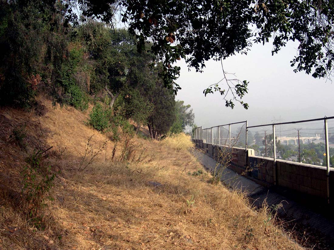
The Red Car Property and the Corralitas Red Car Property are the same piece of land. For decades, developers only wanted to develop the southern end of the Red Car Property at Corralitas Drive. It was often referred to as the "Corralitas Property." Once we learned of the history of the neighborhood, we rebranded it as the Corralitas Red Car Property.

Corralitas Drive is still the easiest access to the property for people driving to it. If you're on foot, the neighborhood connects via sidewalks and public staircases at numerous places along the mile-long property.

See also: The Legacy of Failed Development

Tuesday, May 18, 2010

Menlo Property: Political Theater


Photo: August 13, 2009. Menlo Property looking toward Griffith Park and LA River. (Click on photo to enlarge.)

At last week's PLUM hearing for the Santa Monica Mountains Conservancy's (SMMC) appeal of the City's decision to approve 120 units on the Menlo Property without requiring a trail, City Councilmember Tom LaBonge made quite an entrance at the end of the hearing. Waving a map of his district, he testified that the equestrian trail should be moved to the east bank of the LA River. He admitted having no idea how to get the horses back across the river to Elysian Park. The SMMC nor the public was allowed to comment further in the hearing on LaBonge's proposal.

The El Pueblo Trail is called an "equestrian trail" in the Community Plan. The 1968 Equestrian Trails Master Plan for the City encourages hikers to use equestrian trails, as it makes them safer. It shows a general alignment in the area, though not as specific as the Community Plan, first adopted in 1984.

Photo: Diane Edwardson, June 23, 2007. Horses on the El Pueblo Trail, Red Car Property at Corralitas Drive. (Click on photo to enlarge.)

Removing the trail, an element of the Community Plan, from the proposed Menlo Property development, would set precedent in our neighborhood, affecting any future trail easement on the Corralitas Red Car Property (south of Fletcher). It would also allow planned trails throughout the City to be ignored when ever a developer decides they don't want the trail on their property. It is an affront to Community Planning.


Photo: John Waiblinger, July 24, 2009. Horses on the LA River north of Los Feliz.

Moving the trail to the other side of the LA River may have merit, however, it needs to be properly vetted in a public process, via a General Plan Amendment with regard to the Menlo Property development proposal. Not only that, if this is a real proposal to move the trail to the other side of the river, it needs to through a public process with all of the involved neighborhoods and associated Community Plans on both sides of the river.

You can't just pick up the trail and move it arbitrarily.

The SMMC appeal is on the City Council Agenda Wednesday, May 19, 2010.

Monday, May 10, 2010

Menlo Property: Appeal Hearing Tomorrow


SMMC map of feasible Griffith Park to El Pueblo Trail alignment; segment between Hyperion and the Corralitas Red Car Property at Fletcher. (Click on photo to enlarge.)

The City failed to require dedication of a trail on the Menlo Property when it approved the 120 unit condo development. The Griffith Park to El Pueblo Trail has been in the Silver Lake - Echo Park - Elysian Valley Community Plan since 1984. The trail is the key link in the Santa Monica Mountains Conservancy's (SMMC) Rim of the Valley Trail.

If the City denies the SMMC's appeal, it will set precedent for eliminating trails from Community Plans throughout the City without a formal Plan Amendment process.

It also calls into question the City's value of Community Plans. Why bother with the Community Plan if developers and the City just ignore it? (But then, the City Planning Website isn't exactly set up to be community friendly.)

City Council's Planning & Land Use Management (PLUM) Committee will hear the SMMC's appeal tomorrow.

PLUM Committee Hearing
Tuesday, May 11, 2010
3PM
City Hall, Room 350
200N. Spring St.
Los Angeles, CA 90012

Council File # 10-0716