Photo: Jonathan Vandiveer, November 22, 2015. The native Sycamore trees are dropping their leaves for fall along Fletcher Drive between the Red Car Property and the LA River. (Click on photos to enlarge.)
Photo: Jonathan Vandiveer, November 22, 2015. The Fletcher Bridge over the LA River is a City of Los Angeles Historic Landmark. You can access the river trail on either side of the bridge. If you're on foot or have dogs on-leash, the Atwater side is less crowded, as the path is not as bike friendly.
Showing posts with label Atwater. Show all posts
Friday, November 27, 2015
Tuesday, May 12, 2015
LA River: Red Car Trolley Bridge Footings Will Be Reused For New Pedestrian & Bike Bridge
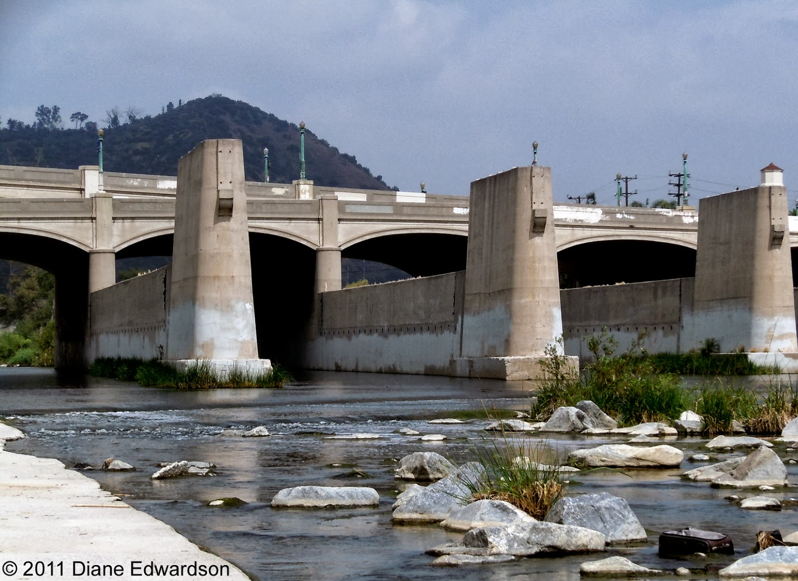
Photo: Diane Edwardson, April 23, 2011. The Big Red Cars last crossed the LA River at the Hyperion Bridge, June 19, 1955. (Click on photo to enlarge.)
This morning, at a press conference in Atwater's Red Car River Park, City Councilmembers Mitch O'Farrell (CD13) and Tom LaBonge (CD4) announced plans for the adaptive reuse of the Pacific Electric bridge footings as the foundation for a new pedestrian/bike bridge connecting Silver Lake with Atwater.
The pedestrian/bike bridge is part of seismic retrofit of the Hyperion Bridge that has been in the works for a very long time - at least the past 10 years (possibly longer).
There's also a public hearing at the Board of Public Works, this Friday, regarding the planned earthquake retrofit and lane alignment of the Hyperion Bridge.
This morning, at a press conference in Atwater's Red Car River Park, City Councilmembers Mitch O'Farrell (CD13) and Tom LaBonge (CD4) announced plans for the adaptive reuse of the Pacific Electric bridge footings as the foundation for a new pedestrian/bike bridge connecting Silver Lake with Atwater.
The pedestrian/bike bridge is part of seismic retrofit of the Hyperion Bridge that has been in the works for a very long time - at least the past 10 years (possibly longer).
There's also a public hearing at the Board of Public Works, this Friday, regarding the planned earthquake retrofit and lane alignment of the Hyperion Bridge.
Labels:
Atwater,
Hyperion Bridge,
LA River,
Silver Lake
Friday, April 17, 2015
LA River: Annual Clean Up, Saturday,
April 18, 2015
Photo: Diane Edwardson, 2010. Although they're becoming more scarce, you'll still see shopping carts in the LA River. (Click on photo to enlarge.)
Friends of LA River (FoLAR) presents
LA Gran Limpieza
9AM - Noon
6 Locations
in the Glendale Narrows
(our section of the river)
Labels:
Atwater,
Elysian Valley,
LA River,
Neighbors take action,
pick it up
Friday, January 9, 2015
Hyperion Bridge: Yet Another Plan
Photo: Diane Edwardson, May 8, 2010.
The City is proposing another plan reimagining the historic landmark Hyperion Bridge when it goes through an earthquake retrofit.
Proposal 1A leaves 2 lanes of vehicle traffic in both directions, but puts pedestrians in direct conflict with bicyclists on 8' wide sidewalks. Expect lots of blowback from the bike & pedestrian lobbies. Considering they can't share a 12' wide path in Elysian Valley - this will be a huge sticking point.
Lots of Red Car Property neighbors have asked me what can be done to alleviate traffic in the area - particularly when it comes to losing car lanes to bike lanes. If you care one way or another, pay attention & speak up to your City Councilmembers now.
See all 3 plans: The Eastsider
The City is proposing another plan reimagining the historic landmark Hyperion Bridge when it goes through an earthquake retrofit.
Proposal 1A leaves 2 lanes of vehicle traffic in both directions, but puts pedestrians in direct conflict with bicyclists on 8' wide sidewalks. Expect lots of blowback from the bike & pedestrian lobbies. Considering they can't share a 12' wide path in Elysian Valley - this will be a huge sticking point.
Lots of Red Car Property neighbors have asked me what can be done to alleviate traffic in the area - particularly when it comes to losing car lanes to bike lanes. If you care one way or another, pay attention & speak up to your City Councilmembers now.
See all 3 plans: The Eastsider
Thursday, October 23, 2014
SR 2 Freeway: Why We Need Trees*
Photo: Diane Edwardson, October 22, 2014. Yesterday, bumper to bumper traffic on the southbound 2 Freeway started around 7 AM & lasted until about noon. Pictured here from Corralitas Drive, that's Corralitas Walk - a less than 10' wide public sidewalk adjacent to the freeway & the Red Car Property. (Click on photos to enlarge.)
*The trees on the opposite side of the northbound lanes 2 Freeway, between Oak Glen & Rosebud, will be replaced with a sound wall. CalTrans claims the wall will go at the top of the slope and minimize tree loss - but those trees are growing right at the top of the slope in a narrow parkway.
Photo: Diane Edwardson, October 22, 2014. By 10 AM the 2 Freeway was still bumper to bumper with the added joy of heavy diesel exhaust from the hoards of big-rig trucks. The fumes were overwhelming as there was no wind. Traffic continued this way until around noon.
Yesterday showed how much one or two incidents can screw up the entire area. Before dawn, CalTrans called a Sig Alert for the molasses spill from a big rig, closing the southbound 5 Freeway in Boyle Heights for a while.
Then there was a bomb scare (lasting until about noon) at Riverside & Fletcher that had people scrambling for alternate routes through Elysian Valley, Atwater & Silver Lake.
It was a good day to stay home with the windows closed & the air purifier cranked up to high.
Click here for all our sound wall posts.
*The trees on the opposite side of the northbound lanes 2 Freeway, between Oak Glen & Rosebud, will be replaced with a sound wall. CalTrans claims the wall will go at the top of the slope and minimize tree loss - but those trees are growing right at the top of the slope in a narrow parkway.
Photo: Diane Edwardson, October 22, 2014. By 10 AM the 2 Freeway was still bumper to bumper with the added joy of heavy diesel exhaust from the hoards of big-rig trucks. The fumes were overwhelming as there was no wind. Traffic continued this way until around noon.
Yesterday showed how much one or two incidents can screw up the entire area. Before dawn, CalTrans called a Sig Alert for the molasses spill from a big rig, closing the southbound 5 Freeway in Boyle Heights for a while.
Then there was a bomb scare (lasting until about noon) at Riverside & Fletcher that had people scrambling for alternate routes through Elysian Valley, Atwater & Silver Lake.
It was a good day to stay home with the windows closed & the air purifier cranked up to high.
Click here for all our sound wall posts.
Saturday, January 11, 2014
2 & 5 Freeway Interchange: Closed Transition Road Reopened Friday
Photo: Chrissy Fiorilli-Ellington, July 13, 2013, 11 AM. A tanker overturned on the northbound 2 to the northbound 5 Freeway transition road spilling more than 8500 gallons of gasoline, that immediately caught fire & spread into the LA River, creating a second scary fire in Elysian Valley. (Click on photo to enlarge.)
After a weekend in July a lot of neighbors would rather forget & months of road closure that was particularly noticeable after Dodger games, the transition road from the northbound 2 Freeway to the northbound 5 Freeway opened Friday with a bunch of politicians & Caltrans officials patting themselves on the back for doing their job & not making us wait 2 years to get it done. Read about it: LA Times
Labels:
2 Frwy,
5 Frwy,
Allesandro,
Atwater,
CalTrans,
Elysian Valley,
LA River,
Riverside Drive,
Silver Lake,
tanker fire
Saturday, December 21, 2013
CD13: Stuff You'd Rather Forget
Photo: Diane Edwardson, March 3, 2013. In what was likely the most contentious primary race ever for City Council District 13 to succeed termed out City Councilmember Eric Garcetti (who later won the equally contentious mayor's race), registered voters were greeted by a daily barrage of campaign mailers sent by 12 candidates; most of whom were a bunch of carpetbaggers, eager to launch a political career in the liberal 13th City Council District. Yup, that's over an inch of mailers collected in my mailbox just for the City Council seat for the March 5 Primary. Even more would arrive for the run-off in May.
Stuff you missed this year: we shoot & collect tons of photos. So we try to wrap up the year with some interesting ones we never got a chance to run.
Labels:
Atwater,
Echo Park,
Elysian Park,
Elysian Valley,
LA River,
politicos,
Silver Lake
Wednesday, September 25, 2013
Hyperion Bridge: 3 Year Rebuild Project
Public Meeting TONIGHT!
Photo: Diane Edwardson, May 8, 2010. Hyperion Bridge facing Atwater, there's not much of a sidewalk on the Hyperion Bridge, it's barely wide enough for one person to walk. (Click on photos to enlarge.)
Community meeting sponsored By CalTrans & City Department of Engineering, TONIGHT:
Photo: Diane Edwardson, May 8, 2010. The sidewalk going up either side of Glendale Blvd from the Hyperion Bridge to Waverly is narrow, but separated from vehicle traffic. (Reverse angle from the first photo above.)
Photo: Diane Edwardson, May 8, 2010. A public staircase descends from the northwest side of the Hyperion Bridge to Riverside Drive. Will the public staircase remain open during construction?
We've included these photos since most people drive through the area, and don't know what features actually exist now.
Read more about the $50 million makeover: The Eastsider
Community meeting sponsored By CalTrans & City Department of Engineering, TONIGHT:
Hyperion Bridge Improvement Project
Wednesday, September 25, 2013
6 - 8 PM
3201 Riverside Drive
Los Angeles, 90027
Read the Environmental Impact Report
Photo: Diane Edwardson, May 8, 2010. The sidewalk going up either side of Glendale Blvd from the Hyperion Bridge to Waverly is narrow, but separated from vehicle traffic. (Reverse angle from the first photo above.)
Photo: Diane Edwardson, May 8, 2010. A public staircase descends from the northwest side of the Hyperion Bridge to Riverside Drive. Will the public staircase remain open during construction?
We've included these photos since most people drive through the area, and don't know what features actually exist now.
Read more about the $50 million makeover: The Eastsider
Tuesday, September 24, 2013
Hyperion Bridge: Reusing Red Car Trolley Footings For New Pedestrian & Bike Bridge*
Photo: Diane Edwardson, April 23, 2011. One of the mitigations for the Hyperion Bridge reconstruction project is a reuse of the old Red Car Trolley bridge footings in the LA River for a new pedestrian & bike bridge. (Click on photos to enlarge.)
The Hyperion Bridge complex was built in 1928, before current earthquake standards. So it's a pretty fair guess that if they're retrofitting the Hyperion Bridge for earthquake safety, there's no way these footings would meet standards for a train bridge today. The last Red Car Trolley crossed the LA River on the Glendale Line, June 19, 1955.

Photo: Diane Edwardson, April 23, 2011.
There is currently no room for a bike path, nor a real safe sidewalk on the Hyperion Bridge, nor was it in the plans for the updated bridge. Thankfully, there was no appetite for a road diet to take away lanes of traffic from the bridge (it's been in the works for years). Yet, it is the only option many students have for walking between Marshall High School & Atwater. It's not a safe way to walk to and from school.
When City Councilmember Mitch O'Farrell was a deputy for (then) Councilmember Eric Garcetti, O'Farrell secured funds from CalTrans to build the pedestrian bike bridge on the Trolley footings. The funds can only be spent on this particular pedestrian bridge project.
We here at the Corralitas Red Car Blog support this low-impact reuse of an important historic resource.
This pedestrian/bike bridge should not be confused with the $6 million North Atwater Multi-Modal Bridge just approved last week by City Council. That one is privately funded & involves equestrian use too.
It should also not be confused with the historic landmark #770, Red Car Viaduct Footings on the Red Car Property at Fletcher & Riverside Drives.
There's a big public meeting Wednesday, September 25, 2013 about the Hyperion Bridge Project.
*Read more on the $50 million dollar Hyperion Bridge makeover: The Eastsider
The Hyperion Bridge complex was built in 1928, before current earthquake standards. So it's a pretty fair guess that if they're retrofitting the Hyperion Bridge for earthquake safety, there's no way these footings would meet standards for a train bridge today. The last Red Car Trolley crossed the LA River on the Glendale Line, June 19, 1955.

Photo: Diane Edwardson, April 23, 2011.
There is currently no room for a bike path, nor a real safe sidewalk on the Hyperion Bridge, nor was it in the plans for the updated bridge. Thankfully, there was no appetite for a road diet to take away lanes of traffic from the bridge (it's been in the works for years). Yet, it is the only option many students have for walking between Marshall High School & Atwater. It's not a safe way to walk to and from school.
When City Councilmember Mitch O'Farrell was a deputy for (then) Councilmember Eric Garcetti, O'Farrell secured funds from CalTrans to build the pedestrian bike bridge on the Trolley footings. The funds can only be spent on this particular pedestrian bridge project.
We here at the Corralitas Red Car Blog support this low-impact reuse of an important historic resource.
This pedestrian/bike bridge should not be confused with the $6 million North Atwater Multi-Modal Bridge just approved last week by City Council. That one is privately funded & involves equestrian use too.
It should also not be confused with the historic landmark #770, Red Car Viaduct Footings on the Red Car Property at Fletcher & Riverside Drives.
There's a big public meeting Wednesday, September 25, 2013 about the Hyperion Bridge Project.
*Read more on the $50 million dollar Hyperion Bridge makeover: The Eastsider
Monday, September 23, 2013
LA River: Hyperion Bridge Construction Project, Meeting Wednesday, Sept 25, 2013
Photo: Diane Edwardson, January 9, 2013. Hyperion Bridge from the Atwater side looking toward Griffith Park. (Click on photos to enlarge.)
CalTrans & the City plan to rebuild the Hyperion Bridge over the 5 Freeway & the LA River. This has been in the works for years. The complex of 3 bridges is in the National Register of Historic Places & is an iconic symbol of the LA River.
The project appears to involve widening of the bridge, realigning a 5 Freeway exit, earthquake retrofitting & a pedestrian & bike bridge addition on the old Red Car Trolley bridge footings. It will take 3+ years & affect a huge swath of Atwater, Los Feliz & Silver Lake as well as all the commuters who will search for new ways to cut through our communities.
Read the 246 page Environmental Review & comment before October 11 or...
Photo: Diane Edwardson, January 9, 2013. The plan calls for a pedestrian & bike bridge constructed on the old footings for the Red Car Trolley Bridge adjacent to the Hyperion Bridge. (We've advocated for this as far back as 2001.)
Click here for all our Hyperion Bridge posts.
CalTrans & the City plan to rebuild the Hyperion Bridge over the 5 Freeway & the LA River. This has been in the works for years. The complex of 3 bridges is in the National Register of Historic Places & is an iconic symbol of the LA River.
The project appears to involve widening of the bridge, realigning a 5 Freeway exit, earthquake retrofitting & a pedestrian & bike bridge addition on the old Red Car Trolley bridge footings. It will take 3+ years & affect a huge swath of Atwater, Los Feliz & Silver Lake as well as all the commuters who will search for new ways to cut through our communities.
Read the 246 page Environmental Review & comment before October 11 or...
GO TO THE MEETING, FIND OUT WHAT IS GOING ON:
Hyperion Bridge Improvement Project
Wednesday, September 25, 2013
6 - 8 PM
3201 Riverside Drive
Los Angeles, 90027
Photo: Diane Edwardson, January 9, 2013. The plan calls for a pedestrian & bike bridge constructed on the old footings for the Red Car Trolley Bridge adjacent to the Hyperion Bridge. (We've advocated for this as far back as 2001.)
Click here for all our Hyperion Bridge posts.
Saturday, September 14, 2013
LA River: A Whole Lot of Stuff Going On
Photo: Diane Edwardson, August 23, 2013. North Broadway Street Bridge crossing the LA River with Elysian Park in the background. (Click on photos to enlarge.)
The Army Corps of Engineers released its feasibility study for ecological restoration of a good portion of the LA River between Griffith Park & Lincoln Heights (thus signaling real estate speculators where the next hot markets will be).
Photo: Diane Edwardson, August 23, 2013. Photo op.
Expect even more PR in the coming month about the river, as City, County, State agencies & all manner of organizations wanting a piece of the river pie, trying to get the public to say, "Yes, we want this to happen," so the Federal government will kick in a big chunk of money. So far, I've seen about dozen announcements and press releases that say very little, other than, read a 500+ page report & comment by November 5, 2013 & go to some community meetings in October.
I'm not for or against this, I just want simple information. After 10 years of studying the river you'd think they could give us a 90 day window & some simple 1-page fact sheets.
Word from Friends of the LA River (FoLAR): In the Study, the Army Corps discusses plans 10, 13, 16 & 20. The Corps has tentatively chosen Alternative 13. River advocates are pushing for Alternative 20.
Alternative 13, estimated cost, $453 million: The Eastsider
You can sort through it yourself:
City of Los Angeles, LA River Revitalization
Army Corps of Engineers DRAFT LA River Ecological Restoration Study
The Army Corps of Engineers released its feasibility study for ecological restoration of a good portion of the LA River between Griffith Park & Lincoln Heights (thus signaling real estate speculators where the next hot markets will be).
Photo: Diane Edwardson, August 23, 2013. Photo op.
Expect even more PR in the coming month about the river, as City, County, State agencies & all manner of organizations wanting a piece of the river pie, trying to get the public to say, "Yes, we want this to happen," so the Federal government will kick in a big chunk of money. So far, I've seen about dozen announcements and press releases that say very little, other than, read a 500+ page report & comment by November 5, 2013 & go to some community meetings in October.
I'm not for or against this, I just want simple information. After 10 years of studying the river you'd think they could give us a 90 day window & some simple 1-page fact sheets.
Word from Friends of the LA River (FoLAR): In the Study, the Army Corps discusses plans 10, 13, 16 & 20. The Corps has tentatively chosen Alternative 13. River advocates are pushing for Alternative 20.
Alternative 13, estimated cost, $453 million: The Eastsider
You can sort through it yourself:
City of Los Angeles, LA River Revitalization
Army Corps of Engineers DRAFT LA River Ecological Restoration Study
Labels:
Atwater,
Elysian Park,
Elysian Valley,
Griffith Park,
LA River,
politicos,
Taylor Yard
Tuesday, July 2, 2013
Marsh Street Park, Elysian Valley:
City Councilmember Mitch O'Farrell Sworn In By The River
Photo: Diane Edwardson, June 29, 2013. Chief Billy Friend of the Wyandotte Tribe of Oklahoma gives Mitch O'Farrell, a Wyandotte Tribe member, the traditional blessing with eagle feathers after the ceremonial offering of the peace pipe in a moving ceremony that brought tears to the eyes of not only Councilmember O'Farrell, but also to many in the audience. (Click on photos to enlarge.)
Photo: Diane Edwardson, June 29, 1013. Chief Billy Friend administers the oath of office to Councilmember Mitch O'Farrell, with Mitch's partner of 21 years, George Braukman by his side at the ceremony attended by several hundred community members from all over City Council District 13 (CD13).
Photo: Diane Edwardson, June 29, 2013. Former CD13 City Councilmember and new Mayor, Eric Garcetti lauded Mitch at the river front ceremony. City Councilmembers Herb Wesson (CD10), Tom LaBonge (CD4) & retiring Councilmembers Ed Reyes (CD1) & Bill Rosendahl (CD11) all praised Mitch for his commitment to community service.
Lewis MacAdams, founder of Friends of the LA River, read one of his poems & the Santa Cecilia Orchestra played before the ceremonies began. The party strolled down the LA River path to RAC Design Build to celebrate with Mitch. All food, beverage, entertainment & labor were donated.
The evening was a who's-who of community activists, many of whom had not seen as much of each other in recent years, since the neighborhood councils have forced many activists to pick battles closer to their homes rather than work together across the communities & on broader issues as much as we used to do. It also gave the opportunity for many of the newer activists a chance to be introduced to the "old timers," many of whom are legendary community activists. So thanks to Mitch for bring us together again.
Mitch O'Farrell took office July 1, 2013.
Photo: Diane Edwardson, June 29, 1013. Chief Billy Friend administers the oath of office to Councilmember Mitch O'Farrell, with Mitch's partner of 21 years, George Braukman by his side at the ceremony attended by several hundred community members from all over City Council District 13 (CD13).
Photo: Diane Edwardson, June 29, 2013. Former CD13 City Councilmember and new Mayor, Eric Garcetti lauded Mitch at the river front ceremony. City Councilmembers Herb Wesson (CD10), Tom LaBonge (CD4) & retiring Councilmembers Ed Reyes (CD1) & Bill Rosendahl (CD11) all praised Mitch for his commitment to community service.
Lewis MacAdams, founder of Friends of the LA River, read one of his poems & the Santa Cecilia Orchestra played before the ceremonies began. The party strolled down the LA River path to RAC Design Build to celebrate with Mitch. All food, beverage, entertainment & labor were donated.
The evening was a who's-who of community activists, many of whom had not seen as much of each other in recent years, since the neighborhood councils have forced many activists to pick battles closer to their homes rather than work together across the communities & on broader issues as much as we used to do. It also gave the opportunity for many of the newer activists a chance to be introduced to the "old timers," many of whom are legendary community activists. So thanks to Mitch for bring us together again.
Mitch O'Farrell took office July 1, 2013.
Wednesday, May 22, 2013
City Council District 13: Score 1 For The Community
Photo: Diane Edwardson, March 6, 2013.
Tuesday, voters in chose Mitch O'Farrell, the local candidate with 32 years of experience living & working in the community as their next City Councilmember.
Read More:
The high price of buying your vote: The Eastsider
Mitch O'Farrell beats the candidate from nowhere: LA Weekly
Mitch O'Farrell wins Council District 13 run-off: Silver Lake Echo Park Patch
Tuesday, voters in chose Mitch O'Farrell, the local candidate with 32 years of experience living & working in the community as their next City Councilmember.
Read More:
The high price of buying your vote: The Eastsider
Mitch O'Farrell beats the candidate from nowhere: LA Weekly
Mitch O'Farrell wins Council District 13 run-off: Silver Lake Echo Park Patch
Labels:
Atwater,
Echo Park,
Elysian Valley,
LA River,
Neighbors take action,
Silver Lake
Thursday, February 1, 2007
Glendale Blvd - Hyperion Bridge Improvement Draft EIR
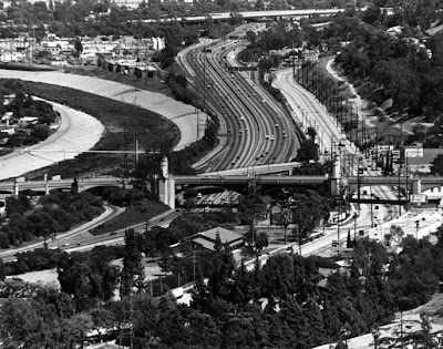
LA River (left), 5 Frwy (center), Riverside Drive (right).
Hyperion Viaduct Complex crosses the LA River and the 5 Freeway at Glendale Blvd. It includes six structures. The Glendale Boulevard (northbound and southbound) and Hyperion structures are currently proposed for major improvement, with cosmetic improvement to the Waverly Ave. Bridge, addition of bike lanes and a realignment of the 5 Frwy offramps.
A public scoping meeting is required under the California Environmental Quality Act (CEQA) to obtain your views of the proposed project and suggestions you might have for its improvement. Your input is very important and will be used to prepare the upcoming Environmental Impact Report (EIR). Please come, ask questions and express your opinions.
For your convenience, two meetings will be held. Each will have the same content and format.
Thursday, February 8, 2007
7 - 9 pm
Glenfeliz Blvd. Elementary School
3955 Glenfeliz Blvd.
Los Angeles, CA 90039
Thursday, February 15, 2007
7 - 9 pm
Silverlake Community Church
2930 Hyperion Avenue (near Rowena)
Los Angeles, CA 90027
The Notice of Preparation and Initial Study can also be viewed on the City's website http://eng.lacity.org/techdocs/emg/Environmental_Review_Documents.htm
The Project is fully described in an Initial Study (IS), which is available for your review at the following locations:
Atwater Village Public Library3379 Glendale Boulevard, Los Angeles, CA 90039
Los Feliz Public Library1874 Hillhurst Avenue, Los Angeles, CA 90027
Satellite Office, Satellite Office, Pres. Eric Garcetti, CD 13, 3700 Verdugo Rd., Los Angeles, CA
90065
District Office, Councilmember Tom LaBonge, CD4, 10116 Riverside Dr., Ste. 200, Toluca Lake, CA 91602
COMMENTS MUST BE RECEIVED BY: Feb 27, 2005
Please send your response to:
Wallace E. Stokes
City of Los Angeles
Public Works, Bureau of Engineering
Bridge Program
221 N. Figueroa Street, Suite 350
Los Angeles, CA 90012
Phone (213) 202-5580
Wallace E. Stokes
City of Los Angeles
Public Works, Bureau of Engineering
Bridge Program
221 N. Figueroa Street, Suite 350
Los Angeles, CA 90012
Phone (213) 202-5580
Fax (213) 202-5518
Labels:
Atwater,
CalTrans,
City Planning Esoterica,
Hyperion Bridge,
LA River,
Silver Lake